Change Detection & Analytical Evidence
Every new product compared against the approved baseline for the same footprint: changed area, confidence and change class.
Task · Sensor links are failing and block launches (3)
Acquire · Products failed to ingest (3)
Awaiting review
11
Confirmed changes
5
Escalated to incidents
5
Total changed area
658ha
A change-detection result is an analytical indicator, not a decision. Confirming, dismissing or escalating is the authorized user's call.
Change Detection & Analytical Evidence
| Run ID | Site name | Channel | Changed area | Confidence | Change class | Review status |
|---|---|---|---|---|---|---|
| CHG-9101 | Wadi NW-14 | Fixed-wing drone | 15 ha | 73% | Pit expansion | Pending review |
| CHG-9100 | Wadi NW-14 | Satellite imagery | 2 ha | 66% | New excavation | Pending review |
| CHG-9122 | Variable Sector 3 — Madinah | Satellite imagery | 6 ha | 70% | Pit expansion | Confirmed |
| CHG-9107 | Jabal SE-07 | Fixed-wing drone | 46 ha | 85% | New excavation | Confirmed |
| CHG-9120 | Variable Sector 1 — Riyadh | Fixed-wing drone | 27 ha | 86% | New processing pond | Pending review |
| CHG-9115 | Makkah Ridge 19 | Satellite imagery | 9 ha | 81% | Pit expansion | Pending review |
| CHG-9109 | Wadi S-12 | Satellite imagery | 25 ha | 69% | Stockpile growth | Dismissed |
| CHG-9112 | Wadi SW-22 | Fixed-wing drone | 17 ha | 90% | Vegetation removal | Confirmed |
| CHG-9102 | Ridge C-11 | Satellite imagery | 28 ha | 80% | Stockpile growth | Confirmed |
| CHG-9103 | Sahl C-03 | Fixed-wing drone | 41 ha | 87% | New access track | Escalated to incident |
| CHG-9117 | Tabuk Wadi 30 | Fixed-wing drone | 35 ha | 95% | New access track | Confirmed |
| CHG-9123 | Variable Sector 3 — Madinah | Fixed-wing drone | 19 ha | 77% | Stockpile growth | Escalated to incident |
| CHG-9110 | Wadi S-12 | Fixed-wing drone | 38 ha | 76% | New access track | Pending review |
| CHG-9118 | Asir Highland 06 | Fixed-wing drone | 48 ha | 72% | Heavy equipment presence | Escalated to incident |
| CHG-9124 | Variable Sector 5 — Tabuk | Satellite imagery | 32 ha | 84% | New access track | Dismissed |
| CHG-9105 | Plain NE-18 | Fixed-wing drone | 20 ha | 71% | Vegetation removal | Pending review |
| CHG-9116 | Tabuk Wadi 30 | Satellite imagery | 22 ha | 88% | Stockpile growth | Pending review |
| CHG-9125 | Variable Sector 5 — Tabuk | Fixed-wing drone | 45 ha | 91% | Heavy equipment presence | Pending review |
| CHG-9111 | Dune W-08 | Satellite imagery | 4 ha | 83% | Heavy equipment presence | Pending review |
| CHG-9104 | Quarry E-09 | Satellite imagery | 7 ha | 94% | Heavy equipment presence | Dismissed |
| CHG-9119 | Najran Plain 17 | Satellite imagery | 14 ha | 79% | Vegetation removal | Dismissed |
| CHG-9113 | Central Mine 02 | Satellite imagery | 30 ha | 67% | New processing pond | Escalated to incident |
| CHG-9106 | Jabal SE-07 | Satellite imagery | 33 ha | 78% | New processing pond | Pending review |
| CHG-9121 | Variable Sector 2 — Eastern | Satellite imagery | 40 ha | 93% | New excavation | Pending review |
| CHG-9114 | Eastern Coast 25 | Satellite imagery | 43 ha | 74% | New excavation | Dismissed |
| CHG-9108 | Basin M-04 | Satellite imagery | 12 ha | 92% | Pit expansion | Escalated to incident |
Before / after
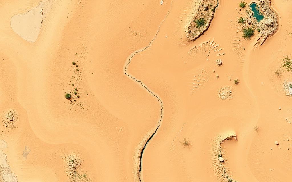
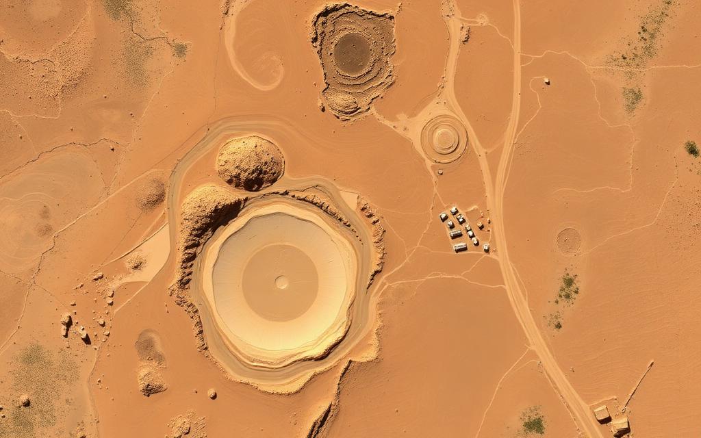
Site name
Wadi NW-14
Baseline age
90d
Changed area
2 ha
Change share
0.45%
Confidence
66%
Analysed
13m
Product reference
SCN-2026100-01
Generated detections
SD-88000
New excavationSeverePending review
Final enforcement authority remains with the authorized user. The system only detects, analyses and recommends.